Ohio Property Line Disputes: 6 Steps Before Calling a Neighbor or Lawyer
By Thomas White, Senior Partner, EQUES Law Group
A fence goes up a few feet from where you expected it. A shed appears close to the side yard. A neighbor says part of the driveway you have used for years is actually on their land.
Property line questions can feel personal fast. They involve your home, your privacy, and sometimes your plans for a fence, garage, pool, addition, or sale. But the first move should not be an angry phone call, a threat, or a trip outside with a shovel.
For Ohio homeowners, the better first move is to gather facts.
The goal is simple: learn what documents exist, understand what they actually say, and avoid turning a fixable misunderstanding into a lasting dispute. These six steps can help you prepare for a calmer conversation with your neighbor and, if needed, a more productive discussion with a surveyor or lawyer.
This article is for general information only. It is not legal advice for any specific property or dispute.
1. Locate your deed
Start with the paperwork from your property purchase. Your deed is the legal document that transferred ownership of the property to you. It should include, or be accompanied by, a legal description of the land.
If you cannot find your deed, request a copy from the county recorder’s office in the Ohio county where the property is located. Ohio deeds are recorded at the county level, and many counties offer online searches. Some records are easier to find than others, so you may need to search by owner name, parcel number, address, or recording information.
Look for the complete deed, not just a summary page. A short property tax record or online parcel description may help you begin your search, but it usually is not enough to settle a property line question.
Your closing file may also include useful documents, such as:
Title commitment or title policy
Prior deed copies
Plats or subdivision records
Survey-related documents
Easement references
Closing attorney or title company notes
If you bought the home recently, ask your title company or closing attorney whether they still have a copy of the complete file. If you bought the property years ago, your county recorder’s office is often the best place to start.
Do not rely only on memory. A seller’s statement, a real estate listing, or a neighbor’s old understanding of the line may be helpful background, but the recorded documents matter.
2. Review the legal description
Once you have the deed, find the part that describes the land conveyed to you. This is the legal description. It may be short and simple, or it may read like a set of instructions from another era.
Many Ohio residential properties fall into one of two general categories.
One common type identifies a lot in a recorded subdivision. For example, the deed may refer to a lot number in a named subdivision or allotment, along with a recorded plat book and page.
Another type uses a “metes and bounds” description. This description uses directions, distances, angles, and references to physical or recorded points. It may mention monuments, roads, adjoining owners, iron pins, stones, or other markers.
If your deed refers to a recorded plat, get that plat too. The plat may show the lot layout, dimensions, roads, easements, and other features that help explain the deed.
A few practical tips can keep this step from going sideways:
Read the full legal description before drawing conclusions.
Highlight references to plats, easements, monuments, and adjoining lots.
Write down words or measurements you do not understand.
Compare documents, but do not assume one document is more accurate just because it is easier to read.
Avoid trying to “survey” the boundary yourself with a tape measure or phone app.
Ohio boundary survey standards call for surveyors to examine deeds and other records, including records for adjoining parcels, and to investigate physical evidence on the property. Your deed is an important starting point, but it is not the whole process.
That point matters in Ohio property line disputes because two deeds can appear to conflict, a fence may not match the record line, or an old marker may have been moved, buried, or misidentified.
3. Find an existing survey and confirm what kind it is
Next, search for any survey documents tied to your property. Start with your closing paperwork. Then check with possible sources such as:
The title company from your purchase
The prior owner, if appropriate
The prior surveyor, if a name appears on a document
The county engineer
The county recorder
Your city, township, or village building department
Availability varies by county and by document type. Some surveys and plats are recorded. Others may exist only in private files. Some may be old, limited, or prepared for a purpose that does not answer your current question.
Pay close attention to the title and purpose of the document. A mortgage location survey or mortgage location drawing serves a different purpose from a boundary survey. In many residential closings, the lender may require a drawing that helps identify improvements and possible encroachments for lending purposes. That does not always mean the document establishes the exact boundary for a fence dispute.
A true boundary survey is a more detailed professional opinion about the location of boundary lines. An Ohio-registered professional surveyor can review what you have and explain whether the document is enough or whether more work is needed.
This is a common trap. A homeowner finds a drawing from the closing packet, sees a line on it, and assumes the question is settled. Then a neighbor produces another document, or a surveyor finds additional evidence in the field. The first drawing may still be useful, but it may not be the final answer.
4. Look for physical evidence on the property
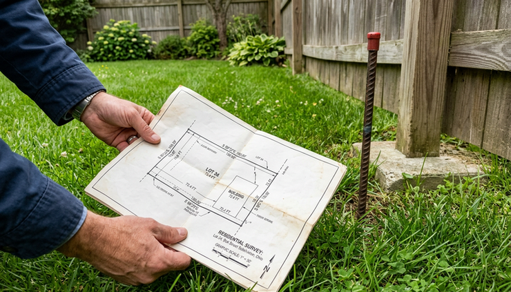
After you gather the documents, walk the property carefully. The goal is not to make your own legal ruling. The goal is to observe what exists and preserve useful information.
Look for physical features that may relate to the boundary, such as:
Fences
Tree lines
Hedges or rows of shrubs
Driveways and parking pads
Retaining walls
Drainage ditches
Utility boxes or poles
Iron pins, pipes, stones, or other possible markers
Old fence posts or remnants
Sidewalks, patios, sheds, or additions
Take clear photos from multiple angles. Include wider shots that show context, not only close-ups. If you photograph a marker, also take a photo showing where it sits in relation to a fence, driveway, or building.
Make notes while the details are fresh. Write down when you first noticed the issue, what changed, and what was said by anyone involved. Keep the notes factual. For example:
“Fence posts installed along east side yard on May 12.”
“Shed appears approximately two feet from fence.”
“Neighbor stated on June 3 that driveway edge crosses their line.”
Avoid loaded phrases like “illegal fence” or “stolen land” in your notes. Those words may feel satisfying in the moment, but they do not help you sort the evidence.
Also avoid moving or removing anything before you understand the boundary. Do not pull up a marker, cut down trees near the line, tear out a fence, or move a neighbor’s property. Self-help can create new legal problems, even if you later learn you were right about the line.
If there is active construction, document it calmly. Photos may help show timing and location. If the work creates an immediate safety concern or violates a local permit rule, contact the appropriate local office rather than confronting workers on site.
5. Talk with an Ohio-registered professional surveyor
If the dispute remains unclear after reviewing your documents, a surveyor is often the right next call. A lawyer can help with legal rights and strategy, but the location of a boundary is usually a surveying question first.
Look for an Ohio-registered professional surveyor with experience in residential boundary work. Share the deed, prior surveys, plats, title materials, and your photos. If the neighbor has provided documents, share those too.
A surveyor may review:
Your deed and legal description
Deeds for adjoining parcels
Recorded plats
Prior surveys
Easement documents
Physical monuments and markers
Evidence of occupation, such as fences or walls
Local records that affect the boundary
The surveyor’s work may result in a boundary survey, marked corners, a survey plat, or an explanation of what additional information is needed. The scope and cost can vary based on the property, the record history, the age of the subdivision, and the condition of field evidence.
Ask clear questions before work begins:
What type of survey are you recommending?
Will corners be marked in the field?
Will I receive a written plat or drawing?
Will you review adjoining deeds?
What limits or assumptions will your work include?
Can the survey be used to address a fence, shed, driveway, or planned improvement?
You do not need to become a surveying expert. You do need to understand what the surveyor is being asked to do. “Tell me where the line is” sounds simple, but the professional task behind that answer can be detailed.
Once you have a surveyor’s opinion, keep the full document. Do not rely only on a verbal summary or a single stake in the ground.
6. Approach the neighbor with facts before the dispute hardens
A property line issue can become a neighborhood feud if the first conversation starts with blame. Once you have documents, photos, and perhaps a surveyor’s input, plan a calm approach.
A brief, factual conversation often works better than a long argument. You might say:
“I noticed the new fence may be close to the property line. I pulled my deed and found a prior survey, but I want to make sure we are both looking at the right information. Can we compare documents before either of us takes the next step?”
That kind of opening does three things. It identifies the concern, shows you are not guessing, and gives the neighbor room to respond without feeling attacked.
If talking in person is likely to become tense, put your concern in writing. Keep the message short and polite. Attach or offer to share documents. Ask for the documents they are relying on. Suggest that both sides use a qualified surveyor if the paperwork does not resolve the issue.
Save copies of letters, emails, text messages, photos, survey documents, and notes. If the situation later requires legal help, an organized timeline will save time and reduce confusion.
Some disputes need a lawyer sooner rather than later. That may be true if:
Construction is ongoing and may cause permanent damage.
A neighbor threatens to remove a fence, trees, or improvements.
Someone claims ownership based on long-term use.
An easement, shared driveway, or access issue is involved.
The disputed area affects a sale, refinance, or building permit.
Direct communication has become hostile.
The survey results conflict with how the property has been used for many years.
A lawyer can help review the survey, evaluate claims, communicate with the neighbor or their attorney, and explain court or settlement options. In some cases, the answer may involve an agreement, a boundary line adjustment, an easement, mediation, or litigation. The right path depends on the facts and the documents.
What to avoid while you sort it out
Boundary questions reward patience. A few wrong moves can make the problem more expensive.
Avoid these common mistakes:
Do not assume the fence is the line. Fences are often placed for convenience, terrain, cost, or privacy.
Do not rely on online parcel maps alone. County GIS maps can be helpful for reference, but they are not usually a substitute for a boundary survey.
Do not trespass to prove a point. Stay calm and avoid entering a neighbor’s property without permission.
Do not alter possible markers. Moving a pin, pipe, stone, or monument can harm the evidence.
Do not ignore the issue during a sale or construction project. A small boundary question can become a larger title, permit, or closing problem.
The best approach is steady and documented: deed, legal description, plats, existing surveys, physical evidence, surveyor input, then neighbor discussion.
A clear process can lower the temperature
Most property line disputes start with uncertainty. The fence looks wrong. The shed feels too close. The driveway has been used one way for years, but the paperwork seems to say something else.
Before calling your neighbor in frustration or calling a lawyer in panic, gather the facts. Locate the deed. Read the legal description. Find existing surveys and confirm what they were prepared to do. Document the property as it exists. Get help from an Ohio-registered professional surveyor when the line is unclear. Then approach the neighbor with records, not accusations.
A calm, organized process will not resolve every dispute. But it gives you the best chance to protect your property, reduce conflict, and make the next conversation useful.


Comments